



Is California at Risk of Earthquakes from the San Andreas Fault?
Researchers at San José State University discovered that a section of the San Andreas Fault is slipping faster than previously thought, raising concerns about earthquake risk in California. The findings emphasize the importance of updated earthquake preparedness and building standards.

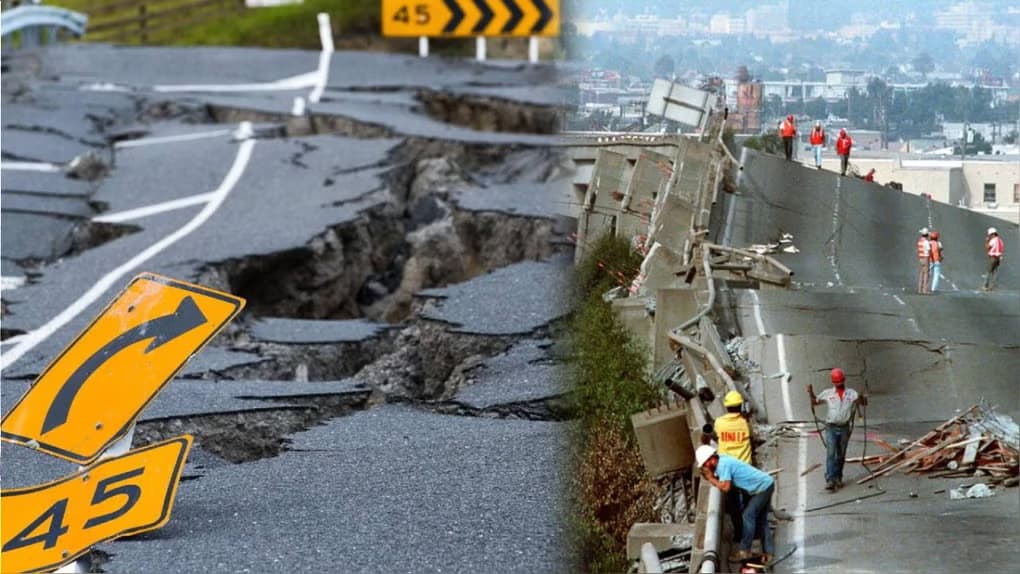
This summer has brought together, in just a few weeks, several earthquakes with magnitudes greater than 7 degrees in different parts of the planet. Amid this coincidence, a new study focuses on the San Andreas Fault and the risks it poses to California. Researchers at San José State University discovered that a section of the fault is slipping faster than previously thought, according to the San Francisco Chronicle.
What did the new study on the San Andreas Fault find?
Geologist Kim Blisniuk, a professor at San José State University, led the research. Her team analyzed 10,000 years of geological history in the section of the Santa Cruz Mountains, south of the San Francisco Bay. Previous studies only covered a range of 1,000 years, so the new work offers a much broader view of the fault’s behavior, as explained by the San Francisco Chronicle.
The finding is relevant because faults with higher slip rates typically produce earthquakes more frequently. This is warned by the U.S. Geological Survey (USGS). However, the relationship is not direct, since the intervals between major earthquakes can vary considerably.
Does this finding increase the risk of a major earthquake in California?
Geologist and science communicator Nahúm Méndez-Chazarra noted that there is no reason to feel immediate fear. However, he considered that the study can serve as a warning not to let our guard down. According to him, the San Andreas Fault did not suddenly accelerate its tension this week; what is happening is that better tools now exist to analyze its movement.
Méndez-Chazarra clarified that this data does not imply imminent risk or a specific date. Seismic risk in California has always been high and inevitable in the long term. What changes, according to the specialist, is the precision with which the phenomenon can now be measured and risk maps updated.
By knowing more accurately the rate at which tension accumulates in the fault, engineers and authorities can improve earthquake-resistant building standards. Therefore, the geologist insisted that earthquake prevention and preparedness should not be optional in California, but mandatory for the entire population.
How likely is a major earthquake in California?
The Uniform California Earthquake Rupture Forecast, known as UCERF3 and developed with the U.S. Geological Survey, calculates the probabilities of large earthquakes by region. These calculations are not exact predictions, but statistical estimates based on historical data and satellite measurements of ground deformation.
| California Region | Probability in 30 years of an earthquake of magnitude 6.7 or greater |
| Southern California (Los Angeles) | 60% |
| San Francisco Bay Area | 72% |
| Entire state of California | More than 99% |
The table above confirms that no area of the state is exempt from risk. Still, the San Francisco Bay Area, where the section studied by Blisniuk is located, has one of the highest probabilities.
Are the earthquakes of magnitude 7 or greater recorded in the last month connected?
Méndez-Chazarra explained that each day, tens of thousands of earthquakes occur on the planet naturally. Most are not felt, but each year typically 10 to 15 earthquakes of magnitude 7 or greater are recorded. This figure coincides with data compiled by the U.S. Geological Survey on global seismic activity.
The specialist compared the phenomenon to a lottery draw. All the numbers are in the drum and come out randomly. Sometimes, the big prizes—that is, major earthquakes—come out in succession. It is, according to him, pure statistics and probability, not a hidden pattern.
For this reason, the fact that several large magnitude earthquakes have occurred in nearby weeks does not reflect a real change in the planet’s behavior. It is, simply, a coincidence of dates that does not represent an increase in global seismicity.
What are the areas of greatest seismic risk on the planet?
According to Méndez-Chazarra, the so-called Ring of Fire of the Pacific concentrates much of the world’s seismic risk. This zone spans the west coast of North and South America, including much of Mexico. It also includes areas of Turkey, China, Nepal, Japan, Indonesia, and New Zealand.
Destructive earthquakes can occur in all these regions at any time. What science still cannot determine is the date, time, or exact location of the next major rupture. Therefore, the geologist insisted on the importance of keeping risk maps and building codes up to date.
| Northern segment of the fault |
Canal oficial
Únete a nuestro canal de WhatsApp
Recibe las noticias más importantes al instante, sin spam. Solo lo que importa, cuando importa.
Etiquetas

Comentarios
Inicia sesión para comentar
Es gratis y toma un minuto. Con tu cuenta también podés:
- Comentar y participar en la conversación
- Guardar notas para leer después
- Ver tu historial de lectura
- Recibir el boletín con tus temas favoritos